Senja
Hesten and Segla from Fjordgård, the coast path from the tender, and the boardwalk day for when the summits are in cloud.
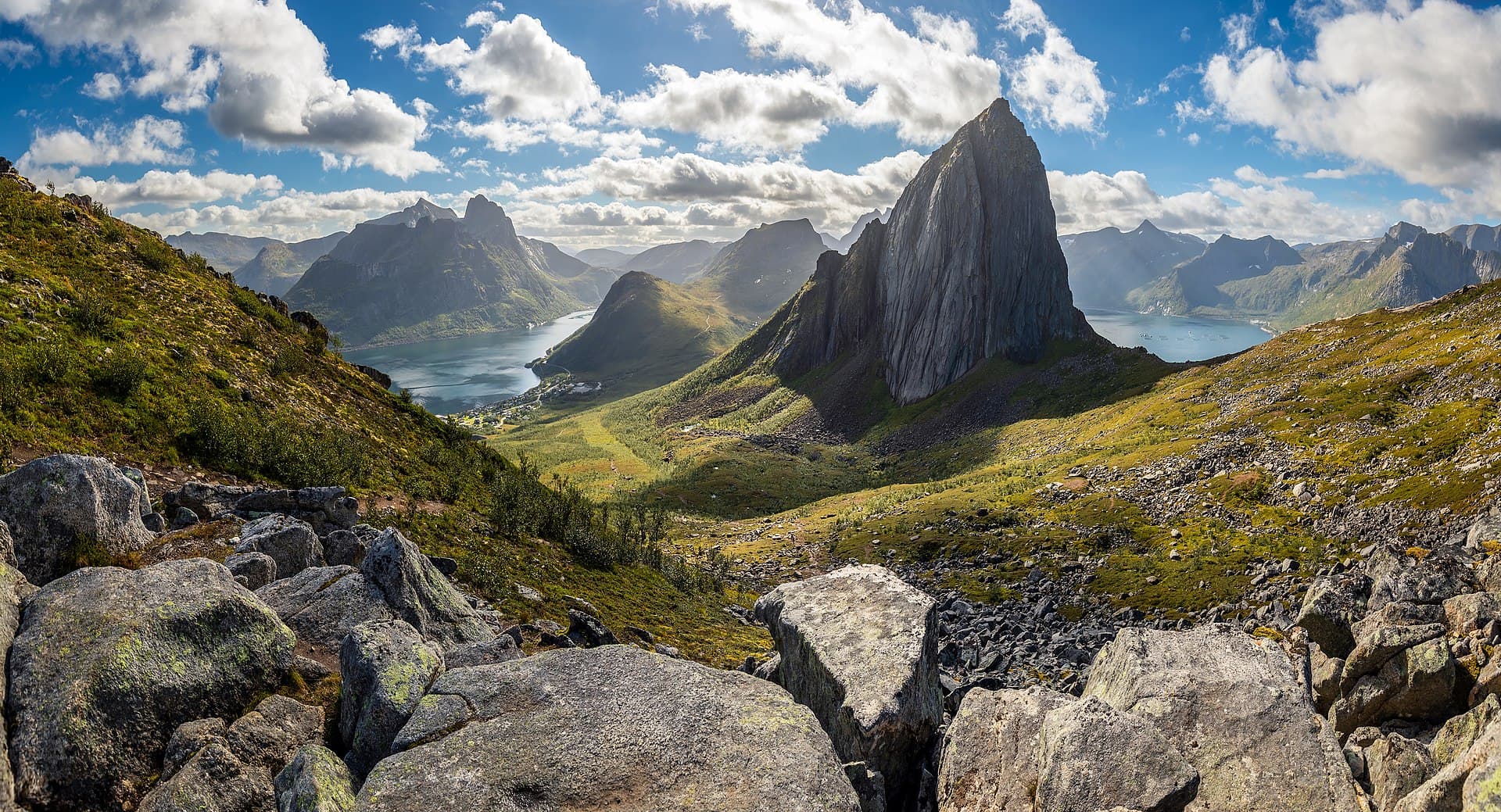
Senja is Norway's second-largest island and it is really two islands stuck together: a wide forested interior nobody photographs, and an outer coast of blade-thin peaks standing straight out of the sea. Every walk in this guide is on the outer coast, from the tender at Mefjordvær or a short shuttle ride along the road from it. The mountains here are lower than they look and steeper than they read — Segla is 639 metres and you gain almost all of it in two and a half kilometres. It is not empty — Fjordgård, a village of a hundred, takes tens of thousands of walkers a summer and its car park is full by ten in July — but the coast path from the tender is, and nobody takes it.
Going ashore
There is no cruise port on Senja and this guide does not pretend otherwise. Expedition ships anchor in Mefjorden and land by tender at Mefjordvær, 100 metres from Mefjord brygge — the lodge with the café, the toilets and the only roof for walkers. Trail A leaves the quay on foot; the other three start 14 to 22 kilometres away along the Fv 862 and depend on the ship's shuttle, because no bus fits a ship's day, taxis come from Finnsnes, ninety minutes away, and there is no car hire nearer than Finnsnes. Some ships land walkers at Fjordgård by boat instead, which puts you at the foot of Segla at 08:00.
The hikes
- 01
The coast path to Skøyteneset
6.5 km · 3.5 hours · 150 m upThe only walk that starts at the tender: over the neck to Halsen and along the shore of Mefjorden to a headland facing the open sea. Rough, low, empty. The free chapter.
- 02
Ersfjord beach and Tungeneset
3 km · 1.5 hours · 40 m upA white sand beach under 700 m walls, Norway's most photographed toilet, and a walkway over the rocks to the Okshornan peaks. Level, short; the wet-day walk.
- 03
Hesten — the mountain that looks at Segla
4 km · 3.25 hours · 550 m upA steep, marked path from Fjordgård to a 556 m summit whose whole point is the view of Segla's overhanging face. The photograph everyone has seen is from here.
- 04
Segla
5 km · 6 hours · 640 m up639 m straight up from the village to a summit that ends in a sheer drop, with a ridge near the top that wants dry rock and a head for edges. Read page 16 first.
What's inside
Look inside
Pages 1–6 are in the free sample. 34 pages in the full guide.
What the guide covers
- Segla
- Hesten
- Fjordgård
- Husfjellet
- Steinfjord
- Tungeneset
- Okshornan
- Bergsbotn
- Ersfjord
- Mefjordvær
- Skøyteneset
- Anderdalen National Park
4 routes · 19 km · 34 pages
When to go
Late June to mid-September is the season for the summits — the snow goes off Hesten by the middle of June and off the Segla ridge by the end of it, and Segla is the first to ice again — while the coast path and the beach are open from May. Midnight sun runs from about 21 May to 21 July, which makes an evening ascent both possible and the emptiest hour of the day. Aurora season is September to March, and Senja is dark enough that you do not have to go anywhere for it. Outside the season these are winter mountains with real avalanche terrain, and the guide does not describe them as anything else.