Hellesylt
The waterfall through the middle of the village, the hill above it, the old fjord road, and the farm a rockfall drowned in 1908.
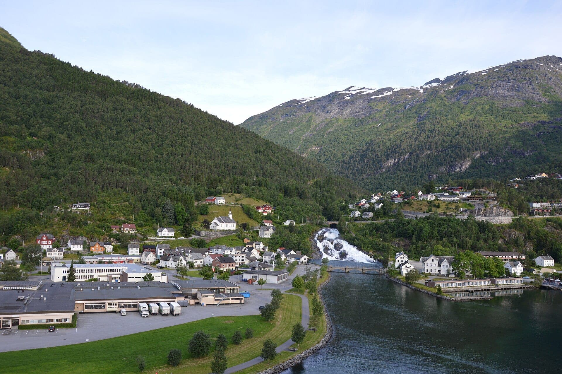
Hellesylt is a village of 250 at the head of the Sunnylvsfjord, where the Geirangerfjord branches off. Most ships stop for an hour to land a coach party that drives over the mountain to Geiranger while the ship sails round, and this guide is for the people who stay — and for the ships that give the village a day. A waterfall through the middle of it, a hill above it with the fjord below, an old road along the water, and a valley behind. It is the other end of the Geirangerfjord and the quieter end, which is the whole argument for walking it.
Going ashore
Ships tie up at the quay on the north side of the village or tender to it, and the waterfall bridge, the hotel and the shop are 300 m along the road. The church is on the hill to the south-west; the old fjord road to Ljøen leaves north from the quay. Trails A, B and D start at the gangway and need nothing. C is 12 km up Norangsdalen and needs the shuttle or a taxi, which is not on every ship — ask. What decides the day is how long the ship stays: an hour is trail D, three hours is A or B, five or more is C with a shuttle or A and B together. Ask the gangway for all-aboard rather than the coach's departure, because they are not the same clock.
The hikes
- 01
Ringdalsåsen — the hill above the village
5 km · 2.5 hours · 250 m upThe village sits in the angle between the fjord and the river, and the hill west of it has a lane and then a path up through farms and birch to a shoulder 250 m above the water. The whole fjord head is below: the village, the fall, the ship at its quay, and the Sunnylvsfjord running north between its walls to the point where the Geirangerfjord turns off. It is the view the coach passengers get from the road and you get from a bench. Free, from the gangway, with the waterfall on the way. Village pavement, then a tarmac lane through the farms, then gravel and grass that is wet after rain and steep in the last third. Step-free as far as the fall; not up the hill.
- 02
The old road along the fjord
6 km · 2.5 hours · 120 m upNorth from the quay a road was cut into the fjord wall in the 1880s to reach the farm at Ljøen, and when the new road went through a tunnel the old one was left to walkers: 3 km of gravel ledge above the Sunnylvsfjord, the water 30 m below on one side and the rock on the other, out to a headland where the fjord opens and the mouth of the Geirangerfjord is straight across. Out and back, with the ship in view the whole way home. A gravel road closed to cars, with a gentle climb from the quay and one steeper rise to the headland. Level enough for anyone who can walk 6 km, and empty.
- 03
Norangsdalen — the drowned farm
5 km · 3 hours · 100 m upSouth of the village the road climbs Norangsdalen, a valley so narrow the sun leaves it early, past a lake that was not there before 1908: that spring a rockfall from the valley wall dammed the river and drowned the summer farm of Lyngstøyl, whose stone walls and cabin foundations are still visible on the bottom through clear water. The walk follows the old road along the lake shore and up the valley to the next farm, in the greenest and steepest valley on this coast, and comes back the same way. The three hours are on foot; getting to the trailhead is 12 km up the road by shuttle or taxi, and the fare is printed in the guide as unconfirmed rather than guessed. Worth arranging, and worth asking whether your ship runs it at all.
- 04
The waterfall and the church
1.5 km · 50 min · 40 m upFifty minutes, and never more than ten from the gangway — built for the hour while the coach loads, or the last hour before the ship sails round to Geiranger. The fall from the bridge and then from below, the lane up to the church of 1859 on its knoll with your own ship beneath you, and back along the river. Pavement, a lane, and steps down to the fall's foot. The bridge and the church lane are step-free; the steps to the fall are not. It is also the wet-day walk: the fall is better in rain.
What's inside
Look inside
Pages 1–6 are in the free sample. 34 pages in the full guide.
What the guide covers
- Hellesyltfossen
- Hellesyltbrua
- Sunnylven kyrkje
- Peer Gynt gata
- Ringdalsåsen
- Ljøvegen
- Sunnylvsfjorden
- Norangsdalen
- Lyngstøylvatnet
- Urasætra
4 routes · 18 km · 34 pages
When to go
The fall is loudest in June and quietest in September; the drowned farm is clearest in June and late July; the hill path is dry from mid-July. A June call and a September call are two different villages. The shuttle up Norangsdalen that trail C depends on is not run by every ship, so that walk is the one to confirm before counting on it.