Geiranger
Storsæterfossen, the shore path to Homlong and the Skageflå cliff farm — with the climbs measured rather than guessed.
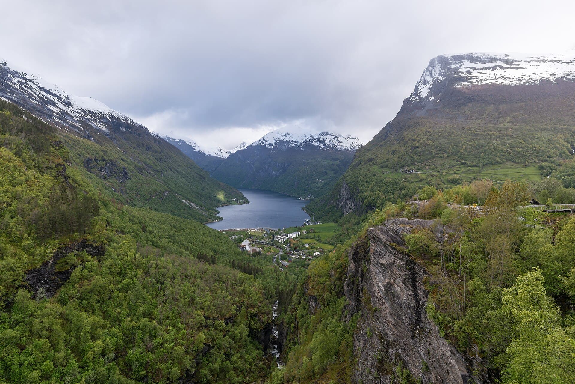
Geiranger is a village of a few hundred people at the head of a fjord that carries a UNESCO listing and, on a summer day, several thousand visitors. The fjord walls rise more or less straight out of the water, so almost every walk here is a climb — the one flat option is the shore path along the foot of the cliffs, and this guide does not pretend the others are easy. What you get for the ascent is the thing people come for: the fjord seen from above rather than from the deck.
Going ashore
The village sits at the very head of the fjord, and larger ships anchor and tender in rather than berth. Everything is uphill from the landing, and the heights here are measured against Kartverket's terrain model rather than repeated from a brochure: the Fjord Centre is 80 m up, Vesterås farm 317, Flydalsjuvet 270, Storsæterfossen 551. Skageflå is reached by boat — kr 610 with the pick-up included — or by a long walk over a 538-metre shoulder, and the operator puts that walk at four to four and a half hours one way. Dalsnibba at 1,475 m is a toll road and a bus, not a hike; it opens somewhere between 12 May and 12 June depending on the snow, and closes between 20 September and 18 October.
The hikes
- 01
The village and the viewpoint
3.2 km · 1.5 hours · 180 m upA made path climbs the hillside behind the village to a bench with the whole fjord below it, then drops back down the road. Signposted throughout on stone steps, gravel and tarmac, and the only walk here for ordinary shoes. Forty-five minutes up, thirty down, six stops, no exposure and one steady climb. The walk for a short call, for poor visibility, or when the tender queue has eaten the morning.
- 02
The shore path to Homlong
6 km · 2.5 hours · 90 m upAlong the north shore on a gravel track that barely climbs, 800 m of cliff above and the water beside. The scale of the fjord without earning it in altitude: seventy minutes out, sixty back, eight stops, and the 90 m of ascent comes in short rises. One stony section; pushchair-friendly for the first stretch, and open all year though snow-covered in winter.
- 03
Behind the waterfall
7 km · 3.5 hours · 560 m upA stone path climbs the valley to a fall that drops clear of the rock, with a ledge running behind the water. You walk under it and come out wet, and it is the best thing you can do on foot from this pier. A hundred and ten minutes up, seventy down, ten stops, sustained climbing and wet rock at the top. June to September; snow lies late up there, and it is not a walk for anyone unsure on steps.
- 04
The cliff farm
10 km · 5.5 hours · 550 m upA boat out, a hard climb to a farm abandoned on a shelf 250 m above the water, and a long walk back over the mountain's shoulder. Ninety minutes up and a hundred and eighty back, plus the boat, on steep zig-zags, rock, bog and a loose descent, partly exposed. Eleven stops. A serious mountain day that happens to start near a cruise pier, and the hardest thing in this guide.
What's inside
Look inside
Pages 1–6 are in the free sample. 32 pages in the full guide.
What the guide covers
- Storsæterfossen
- Vesterås
- Storsætra
- Skageflå
- Skagehola
- Homlungsætra
- Homlong
- Norsk Fjordsenter
- Vestnorsk fjordlandskap
- Dei sju systrene
- Geirangerfjorden
4 routes · 26 km · 32 pages
When to go
The high trails are reliably snow-free from about mid-June to late September, and the shoulders of that are a real question rather than a formality. Dalsnibba is the honest measure, because its operator publishes eleven years of actual opening dates: the road has opened as early as 12 May and as late as 12 June, and closed between 20 September and 18 October. It is a toll road, open around the clock in season, and it shuts at short notice for snow or ice — there were maintenance closures on 1 and 2 September 2026. The café at the top runs 09:30–17:00 outside high summer, and the operator's two pages disagree about whether the peak-season closing time is 17:30 or 19:00. The waterfalls are fullest in June on the melt and thinner by August. Outside the season the village is very quiet and none of the routes here is sensible without winter gear.