Eidfjord
Vøringsfossen from the step bridge, the Iron Age grave field above the village, and the farm on the ledge at Kjeåsen.
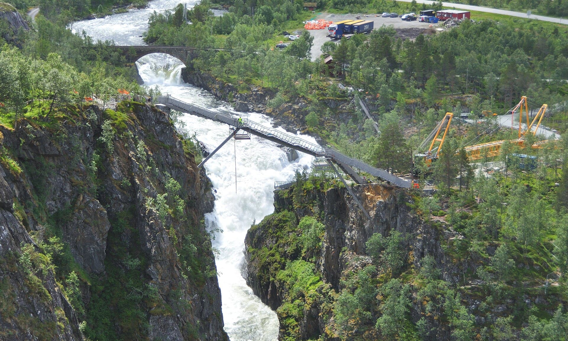
Eidfjord is a village of 900 at the innermost end of the Hardangerfjord, and it is the doorway to the Hardangervidda — the largest mountain plateau in Europe, with wild reindeer on it and a road across it that closes in storms. Between the fjord and the plateau is Måbødalen, a gorge climbing 700 metres in eight kilometres, with Vøringsfossen falling into the top of it. Everything here is about that step up from sea level to plateau — except the first route, the grave field above the village that nobody tells you about, and the fourth, along the fjord shore to the nature centre: the two you can walk from the ship.
Going ashore
Ships come alongside at Cruisekajen, and the church, hotel, shop and tourist office are all within 300 metres. Most of what Eidfjord is famous for is up a valley and needs a shuttle or a taxi — Vøringsfossen is 20 kilometres away and 700 metres up, and Kjeåsen is 16 kilometres up the Simadalen road. But two of the four walks start at the quay and need nothing at all, and this guide leads with one of them, because a guide that tells you every route costs a transfer fare when two of them do not is a guide that has not looked.
The hikes
- 01
Hæreid — the grave field on the plateau
6 km · 2.5 hours · 200 m upPast the 1309 church, over the river and up the old road to a plateau with the largest Iron Age grave field in western Norway — 350 mounds in a meadow — and the fjord 200 m below. From the gangway, free.
- 02
Kjeåsen — the farm on the ledge
4 km · 3 hours · 550 m upThe steepest hour in this series: ladders and cables up a cliff to a farm on a shelf 600 m above the fjord, once the most isolated in Norway. Down by the path or the tunnel road. Shuttle 16 km. Read page 8 first.
- 03
Vøringsfossen on foot
3 km · 2 hours · 150 m upFrom the car park at the top: the platforms over the gorge, the step bridge across the fall, the rim path to Fossli. The waterfall walked, not glimpsed. Shuttle 20 km.
- 04
The fjord shore and the nature centre
5 km · 2 hours · 60 m upWest along the shore to the nature centre — the plateau explained, a film worth the ticket — and back by the lake. Level; the wet-day walk.
What's inside
Look inside
Pages 1–6 are in the free sample. 34 pages in the full guide.
What the guide covers
- Hæreid
- Eidfjord old church
- Eidfjordvatnet
- Hardangervidda natursenter
- Vøringsfossen
- Trappebrua
- Fossli
- Måbødalen
- Kjeåsen
- Simadalen
- Hardangervidda
4 routes · 18 km · 34 pages
When to go
The Hæreid loop is walkable in any month the ground is clear and needs nothing but shoes. Vøringsfossen is at its loudest in June when the melt is on and thins through August as the reservoirs hold back; the platforms and the bridge are railed and work in rain. Måbødalen's old road and stairway want dry rock. Kjeåsen's chained path is for June to September only — earlier it has ice and the ladders are not checked — and the tunnel road to the farm is one-way on a traffic light all year, up on the hour and down on the half-hour. The Hardangervidda road across the plateau closes when the weather says so, which is not a season but a forecast.